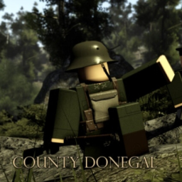
County Donegal, 1937
A Roblox experience owned by ุIrish Free State.
RoleplayENIrish historyborder simulationstone forts
Description (written by the developer; not a statement by this register)
𝐂𝐎𝐔𝐍𝐓𝐘 𝐃𝐎𝐍𝐄𝐆𝐀𝐋 1937 County Donegal, Located at the edge of the Inishowen Peninsula, Our map is based on the Donegal-Northern Irish Border, Donegal is also popular for its Stone Forts. Its Irish name of Grianán Ailigh, the name is roughly translated as Stone Forts of the Sun, and is one of the royal sites of Gaelic Ireland. 🚩JOIN THE IRISH FREE STATE: https://www.roblox.com/groups/8486581/Irish-Free-State#!/about Small gamepasses may be found at the store. Have fun
Last updated by the developer 16 Jul 2023, 20:09 UTC.
Live players over time
Growth
Growth history is still building. We hold one measurement for this entry. A trend needs at least two, taken days apart — so this will fill in on its own rather than being estimated. We do not publish numbers we have not measured.
| Measured (UTC) | Players | Change |
|---|---|---|
| 12 Aug 2026, 13:16 | 0 | first reading |
Concurrent players at each of our measurements (insert-on-change).
Monetization — game passes
Game passes for sale and their prices, measured from the Roblox passes API. Developer products bought inside the game aren’t publicly listable.