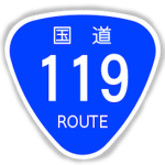
Tochigi Prefecture, Japan Route 119 #35574670
OtherJAgeographyinfrastructurejapan
Description
国道119号 is a national highway located entirely within Tochigi Prefecture, Japan. It connects the city of Nikkō to Utsunomiya, the prefecture's capital, and has a total length of 63.9 kilometers. The present-day highway largely follows the path of the Nikkō Kaidō, an Edo period road that linked Edo and the Shrines and Temples of Nikkō.
Written by the group; not a statement by this register.
Membership history
Growth
Growth history is still building. We hold one measurement for this entry. A trend needs at least two, taken days apart — so this will fill in on its own rather than being estimated. We do not publish numbers we have not measured.
| Measured (UTC) | Members | Change |
|---|---|---|
| 23 Aug 2026, 12:13 | 2 | first reading |
Ownership
Owned by @kaiser6801 as measured.
Groups seen changing owner — the largest ever handed over and the most recent — are on the ownership transfers board.
Members we’ve seen
@kaiser6801 — 所有者 (rank 255)
excaliburtomb (@juzostomb) — メンバー (rank 1) terminated
A sample — only members this register has independently measured, highest rank first. Not the full roster.
Rank structure
Roles and per-rank member counts as Roblox reports them (rank 0 = guest … 255 = owner).
Open data
Download this group’s measured record — free to reuse with attribution: membership history (CSV) · full record (JSON)
Each file carries its licence and retrieval time inside it, and is generated from the same measurements shown above.